Visiting Lanterman’s Mill and Falls at Mill Creek MetroParks
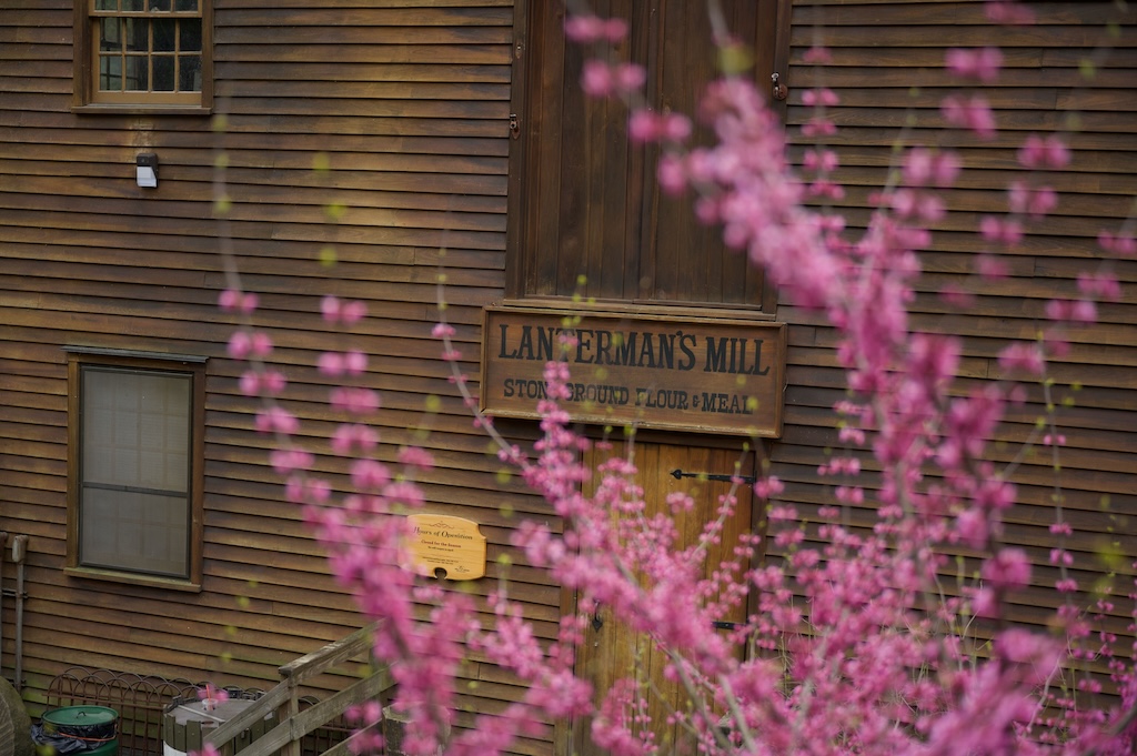
Directions: Points of Interest: Know before you go Lanterman’s Falls, and its namesake Lanterman’s Mill, is located within Mill Creek MetroParks in Youngstown, Ohio. Lanterman’s Mill, originally built in 1845 and fully renovated in 1982, is a fully functional grist mill capable of grinding corn and wheat into flower products. Additionally, Lanterman’s Mill is home […]
Top 10 (non-hiking) Activities in Mill Creek Metro Parks, Ohio

Mill Creek MetroParks offers over 2,800 acres of lush green beauty in the heart of Youngstown, Ohio. Some of the first trails I ever hiked are here in Mill Creek, and hiking is my favorite activity when I visit this park. Hiking, however, is just one of many activities that Mill Creek MetroParks has to […]
Top Spots to Grab a Drink After Day Hiking at Mill Creek Metro Parks

Mill Creek MetroParks, the second largest metroparks in the United States, is located in the middle of Youngstown, Ohio. The south end of the park starts south of Youngstown in the suburb of Boardman and follows the Mill Creek through the South and West Side of Youngstown until Mill Creek meets the Mahoning River near […]
Mill Creek MetroParks Visitor Frequently Asked Questions (FAQ)

Why should I visit Mill Creek MetroParks? Located in the heart of Youngstown, Ohio, Mill Creek MetroParks sprawls across 4,400 acres along the namesake Mill Creek. Founded in 1891, Mill Creek MetroParks is the second-largest Metropark in the United States, second only to Central Park in New York City. Mill Creek MetroParks offers a wide […]
Top 5 Hiking Trails to Explore at Hocking Hills State Park

#5 – Cantwell Cliffs Explore the Cantwell Cliffs area via the Cantwell Cliffs Rim Trail. This area is located 12 miles north of the Old Man’s Cave Visitor’s Center. Enjoy gorgeous views in solitude as this area receives a small fraction of Hocking Hills annual visitors due to its distance from Old Man’s Cave. Location: […]
Hocking Hills State Park Travel Guide
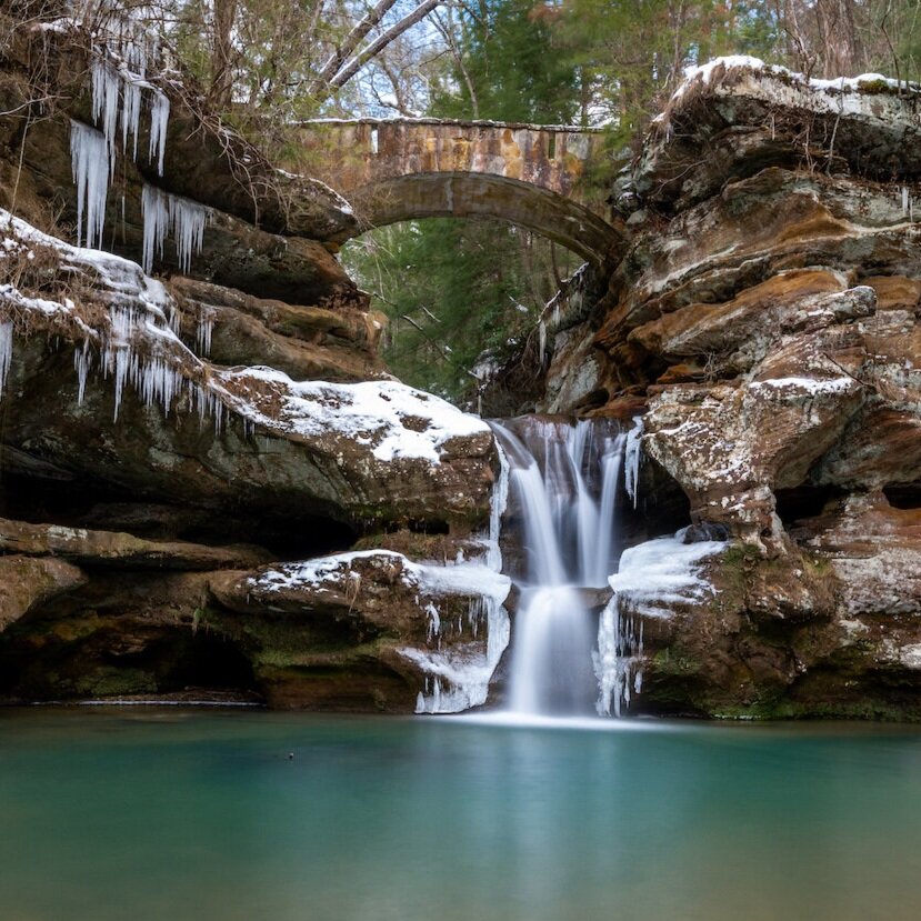
About Hocking Hills State Park What makes Hocking Hills State Park such a unique park? Hocking Hills State Park offers a unique mix of caves, waterfalls, and gorgeous hiking trails not found anywhere else in the state. The massive 700-foot Ash Cave is just one of many large caves found in the area, and the […]
Mill Creek MetroParks Destination Guide

Snag this Backcountry Campsite during your next trip to Cuyahoga Valley National Park

Finding a campsite within Cuyahoga Valley National Park got harder a few years ago when the campsites at the Stanford House were shutdown. For the past few years I was under the impression that the Stanford House sites were the only camping options within Cuyahoga Valley National Park, until I discovered the sites at Ottawa […]
Explore Berea Falls in Cleveland

– Distance & Type: 0.2 Mile Out-and-Back
– Elevation Change: +/- 15-Feet
– Hike Difficulty: Easy
– Hike Features:
– Berea Falls
– Three Arching Stone Bridges
Visit the Great Falls of Tinkers Creek at Viaduct Park
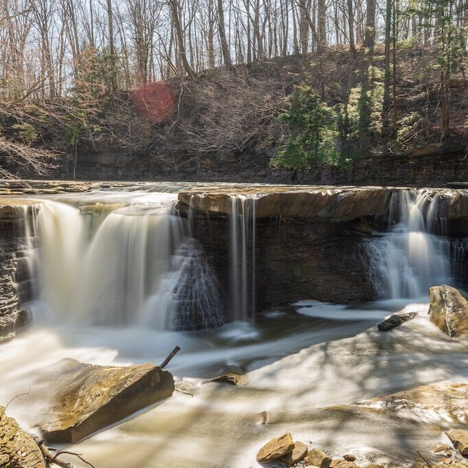
– Distance & Type: 0.5 Mile Out-and-Back
– Elevation Change: +/- 33-Feet
– Hike Difficulty: Easy
– Hike Features:
– Tinkers Creek
– The Great Falls
– ‘The Arch’ and Viaduct